Spring Weather Data Tools
Below are links to several sources that can illustrate current water related data sets.
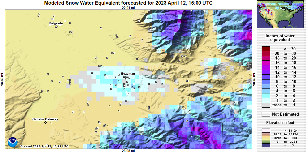
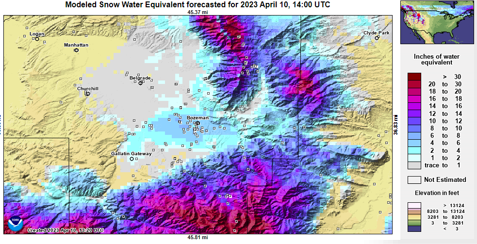
- Snow Water Equivalent (SWE) is the amount of water contained in the snow. This is a better illustration of potential run off than snow depth. View at nrcs.usda.gov.
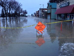
- River Observations show the current water levels (volume) at several locations around the county. This can be depicted in water height (feet) or volume flow (cubic feet per second). View the river basin at weather.gov.
- SnoTel sites are special weather stations to monitor snow conditions. They will report a variety data sets including the snow water equivalent on an hourly basis. View at nrcs.usda.gov.