**This page takes a while to completely load dues to many embedded external data sources.**
Page under development
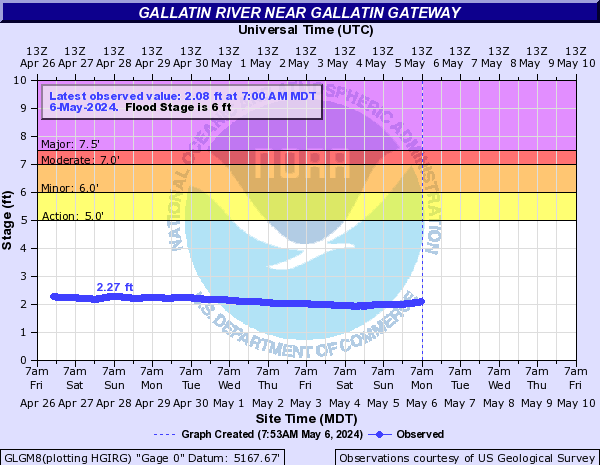
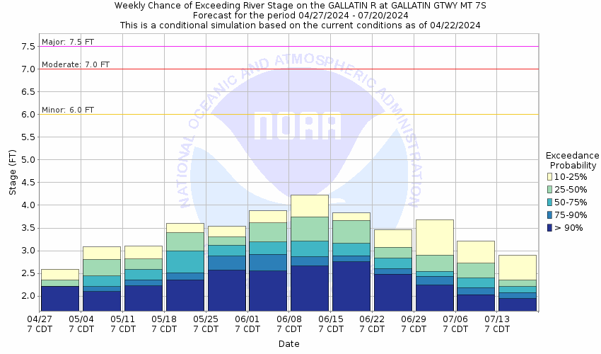
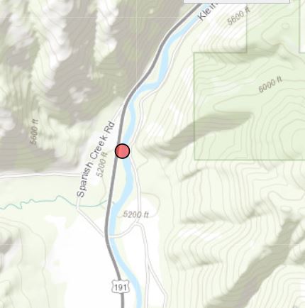
Gallatin River at Gallatin Gateway
About the River
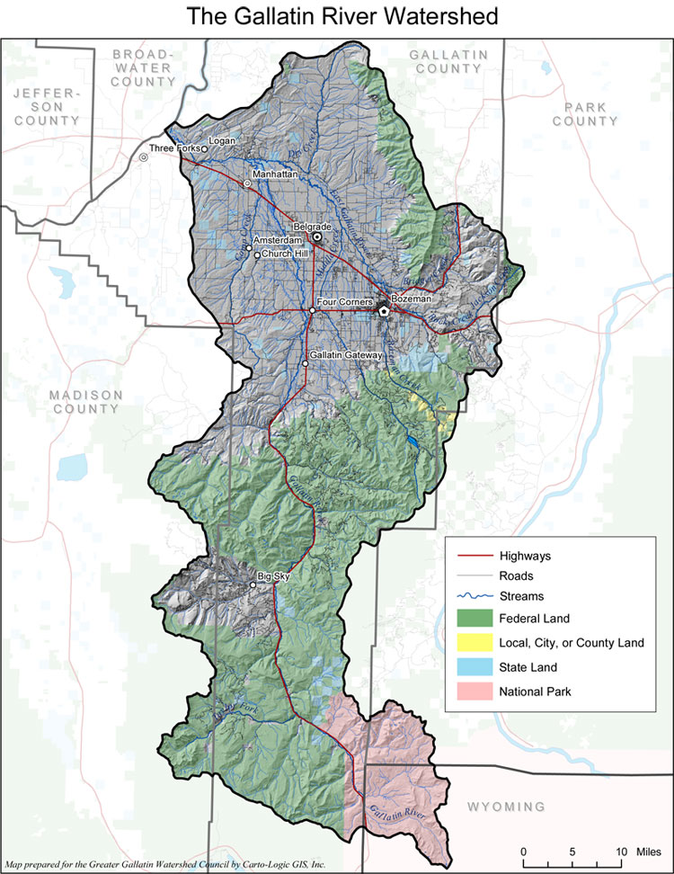
The Gallatin River begins in Yellowstone National Park between West Yellowstone and Big Sky near Fawn Pass. The Gallatin River collects everything coming out of the East side of the Madison Range and the West side of the Gallatin Range. This includes major tributaries of Taylors Fork, West Fork of the Gallatin, Storm Castle, Spanish Creeks and many more.
This location is forecast by the River Forecast Center during the spring.
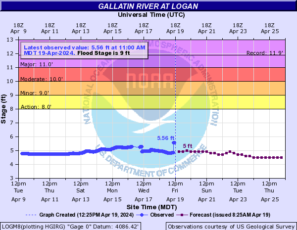
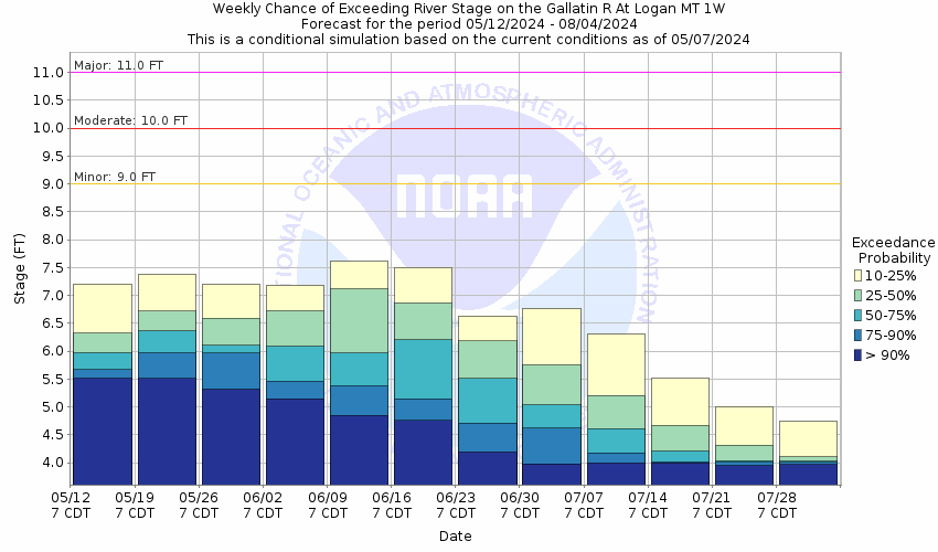
Gallatin River at Logan
About the River
The Gallatin River begins in Yellowstone National Park between West Yellowstone and Big Sky near Fawn Pass. The Gallatin River collects everything coming out of the East side of the Madison Range and the West side of the Gallatin Range. This includes major tributaries of Taylors Fork, West Fork of the Gallatin, Storm Castle, Spanish Creeks and many more. This gauge site sits down river from the Gallatin at Gallatin Gateway and also includes the additional tributaries off the Northern Gallatin Range (such as Middle Creek) as well as the East Gallatin River.
This location is forecast by the river forecast center during the spring.
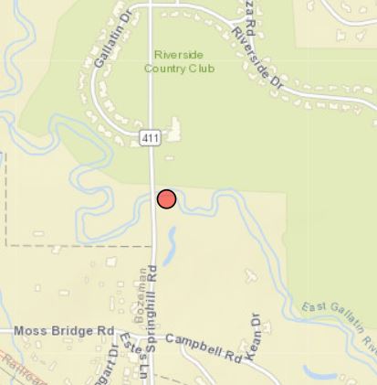
East Gallatin near Bozeman (Springhill Rd)
About the River
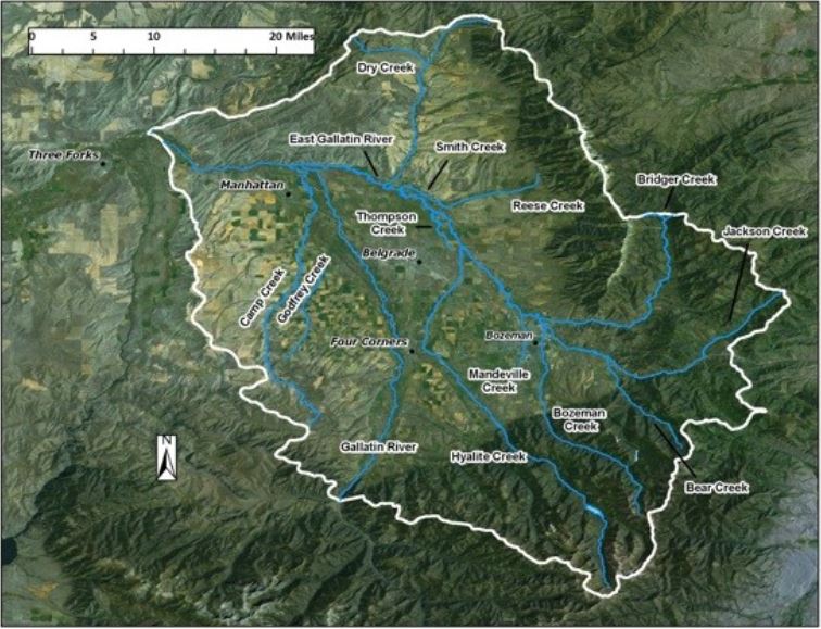
The East Gallatin River begins around Springhill Road and is formed primarily from Bridger, Rocky and Bozeman Creeks. It then meanders to the West crossing Dry Creek Road North of Belgrade before combining with the Main Gallatin River North of Manhattan near Gallatin River Ranch. This river collect much of the water coming out of the Bridger Range, Bozeman Pass area and part of the Northern Gallatin Range (Bozeman Creek).
This river is not forecast by the River Forecast Center, so it will not show flood predictions.

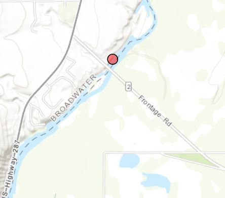
Jefferson River at Three Forks
About the River
The Jefferson River is formed near the town of Twin Bridges from the Beaverhead, Big Hole and Ruby Rivers. The river drains much of the water from the Beaverhead, Big Hole and Boulder valleys. The Jefferson River forms the headwaters of the Missouri River when it combines with Madison River NE of Three Forks.
This river is forecast by the River Forecast Center in the spring.

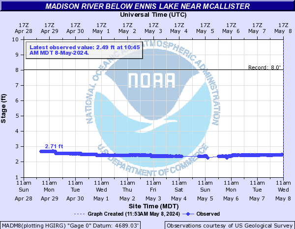
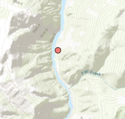
Madison River
About the River
The Madison River is formed from the Firehole and Gibbon Rivers in Yellowstone National Park. It then flows into Hebgen Lake and is released from the Hebgen Dam where if flows into Quake Lake and continues its flow down the Madison Valley where it flows into Ennis Lake. It is then released from Ennis lake by the Madison Dam where the river eventually reaches Three Forks and meets with the Jefferson River to form the Missouri River. Much of the mountains around Hebgen Basin drain into the river as well as the West side of the Madison Range and the East side of the Gravelleys.
This river is not forecast by the River Forecast Center and the flow is controlled by the release from the dams along the river.
Weather Resources
Gallatin River
About the River
The Gallatin River begins in Yellowstone National Park between West Yellowstone and Big Sky near Fawn Pass. The Gallatin River collects everything coming out of the East side of the Madison Range and the West side of the Gallatin Range. This includes major tributaries of Taylors Fork, West Fork of the Gallatin, Storm Castle, Spanish Creeks and many more. Past Gallatin Gateway the river includes additional tributaries off the Northern Gallatin Range (such as Middle Creek) as well as the East Gallatin River. 2 Miles NE of the Missouri River headwaters the Gallatin River joins the Missouri River.