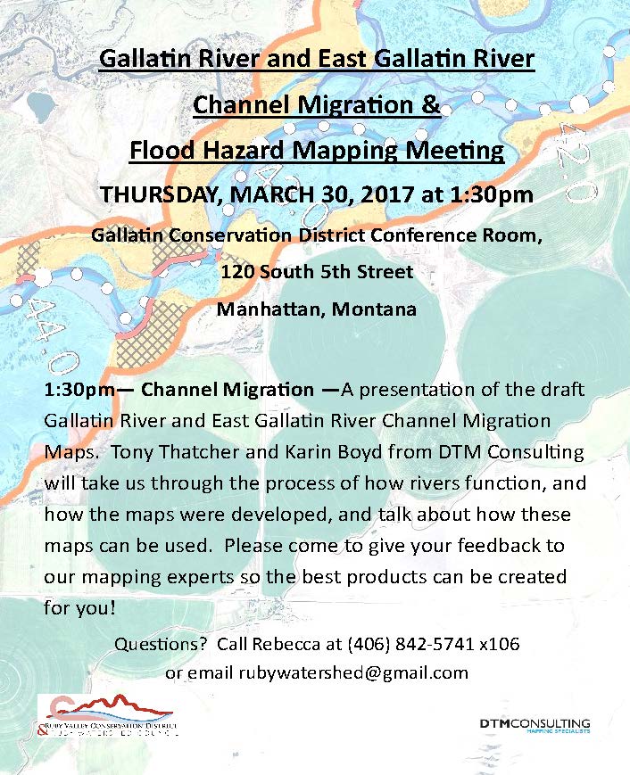
River Channel Migration Zone Mapping Meeting
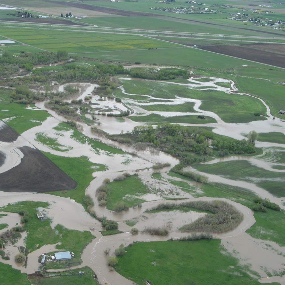
East Gallatin River
The draft report and maps for the channel migration & flood hazard mapping project are ready for the Gallatin and East Gallatin Rivers!
Tony Thatcher & Karin Boyd will be taking us on a trip down these important, dynamic waterways and talking about how those rivers function, some highlights of their discoveries during mapping, how and why the maps were developed, and how these maps are being used.
We will be looking for landowner/stakeholder feedback on the maps and reports for accuracy, and anything that is happening on the rivers that we may have missed. Within the next week or so, you will receive a digital copy of the drafts to review prior to the meeting. The draft report and maps will then be at the Gallatin Conservation District office for you to review and make recommendations if needed before the final products are produced.
Flood Hazard Mapping Meeting
Thursday, March 30, 2017 at 1:30 PM
Gallatin Conservation District
120 South 5th
Manhattan, Montana
We hope you can join us, and pass along this information to your mailing lists of interested parties, stakeholders, local decision makers, etc.
Draft plans can be obtained here.
 Next Post