

Postings from our website
Enhancing Security with Multi-Factor Authentication: A Shield Against Cyber Threats
June 12th, 2023Introduction:
 In today’s digital age, where technology permeates every aspect of our lives, ensuring the security of our online identities and personal data is of paramount importance. The rise in cyber threats and sophisticated hacking techniques necessitates the implementation of robust security measures. Among the most effective defenses is multi-factor authentication (MFA), a method that significantly strengthens the security of online accounts and systems. This article explores the importance of MFA and why it has become an indispensable tool in the fight against cybercrime.
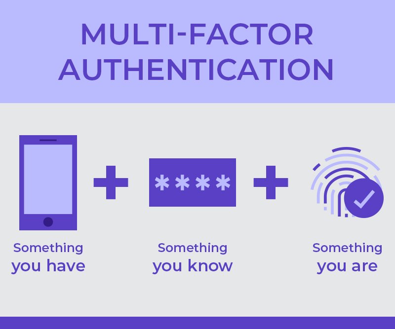
What is Multi-Factor Authentication?
Multi-factor authentication is a security protocol that requires users to provide multiple forms of identification to verify their identity before gaining access to an account or system. It combines two or more authentication factors, typically categorized into three types: something the user knows (e.g., a password or PIN), something the user has (e.g., a smartphone or token), and something the user is (e.g., biometric data like fingerprints or facial recognition). By combining these factors, MFA adds an extra layer of protection, making it significantly more difficult for unauthorized individuals to access sensitive information.
Strengthening Security:
- Defense against Password-based Attacks: Passwords alone are no longer sufficient to protect accounts from unauthorized access. Cybercriminals employ various tactics, such as phishing, brute-forcing, and credential stuffing, to exploit weak or stolen passwords. MFA mitigates this risk by requiring an additional factor beyond a password, significantly reducing the chances of successful account breaches.
- Enhanced User Authentication: With MFA, users have greater control over their own security. By adding an extra layer of verification, MFA ensures that even if an attacker manages to acquire a user’s password, they would still require the additional authentication factor. This gives users peace of mind and helps prevent unauthorized access to their accounts.
- Mitigation of Data Breaches: Data breaches are a significant concern in today’s digital landscape. Companies and individuals can suffer severe consequences when sensitive data falls into the wrong hands. MFA acts as a powerful deterrent to cybercriminals by making it exponentially harder for them to gain unauthorized access, even if they manage to penetrate one layer of security.
- Safeguarding Remote Access: The COVID-19 pandemic has accelerated the trend of remote work, increasing the need for secure remote access. MFA plays a critical role in ensuring the integrity of remote connections, protecting corporate networks, and preventing unauthorized entry into systems that hold sensitive information.
Adoption Challenges and Best Practices:
While the benefits of MFA are undeniable, widespread adoption can face challenges due to usability concerns or resistance to change. However, organizations can encourage adoption by following these best practices:
- User-Friendly Interfaces: Implementing MFA should be intuitive and hassle-free for users. Organizations should strive to provide user-friendly interfaces, clear instructions, and easily accessible support to help users understand and adopt the additional security measures.
- Communication and Education: Organizations should educate their employees or users about the importance of MFA and its role in safeguarding their accounts. Clear and concise communication about the benefits and ease of use can alleviate concerns and encourage adoption.
- Adaptive and Risk-Based Authentication: Organizations can implement adaptive authentication systems that dynamically adjust the level of authentication required based on risk factors such as user behavior, location, or device used. This approach balances security with user convenience, minimizing disruption while still providing robust protection.
Conclusion:
Multi-factor authentication is a critical security measure that has become indispensable in today’s increasingly digitized world. By adding additional layers of verification beyond passwords, MFA significantly reduces the risk of unauthorized access and protects sensitive information from falling into the wrong hands. Organizations and individuals alike should embrace MFA as a powerful tool to fortify
This article was automatically generated with AI.
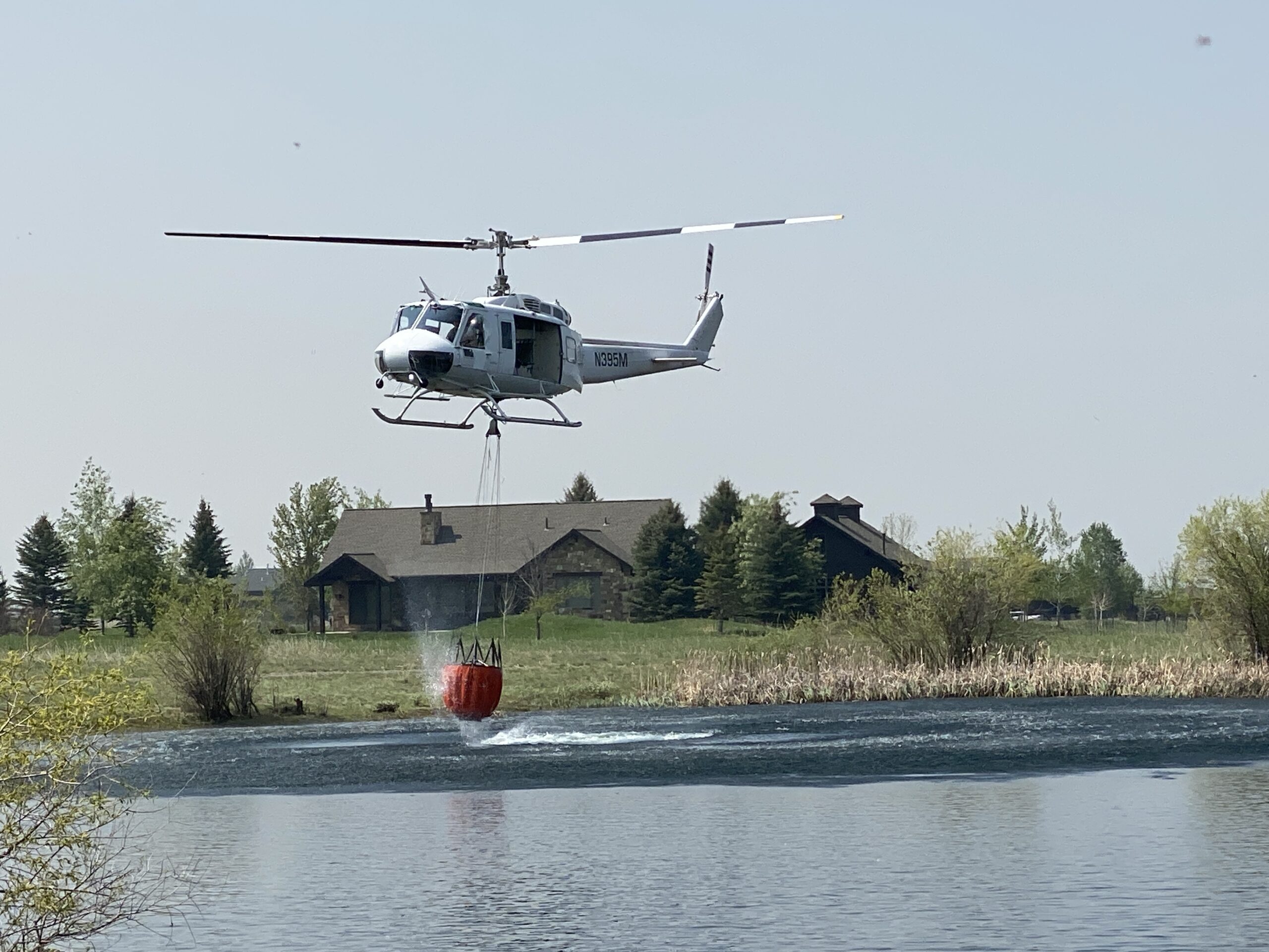
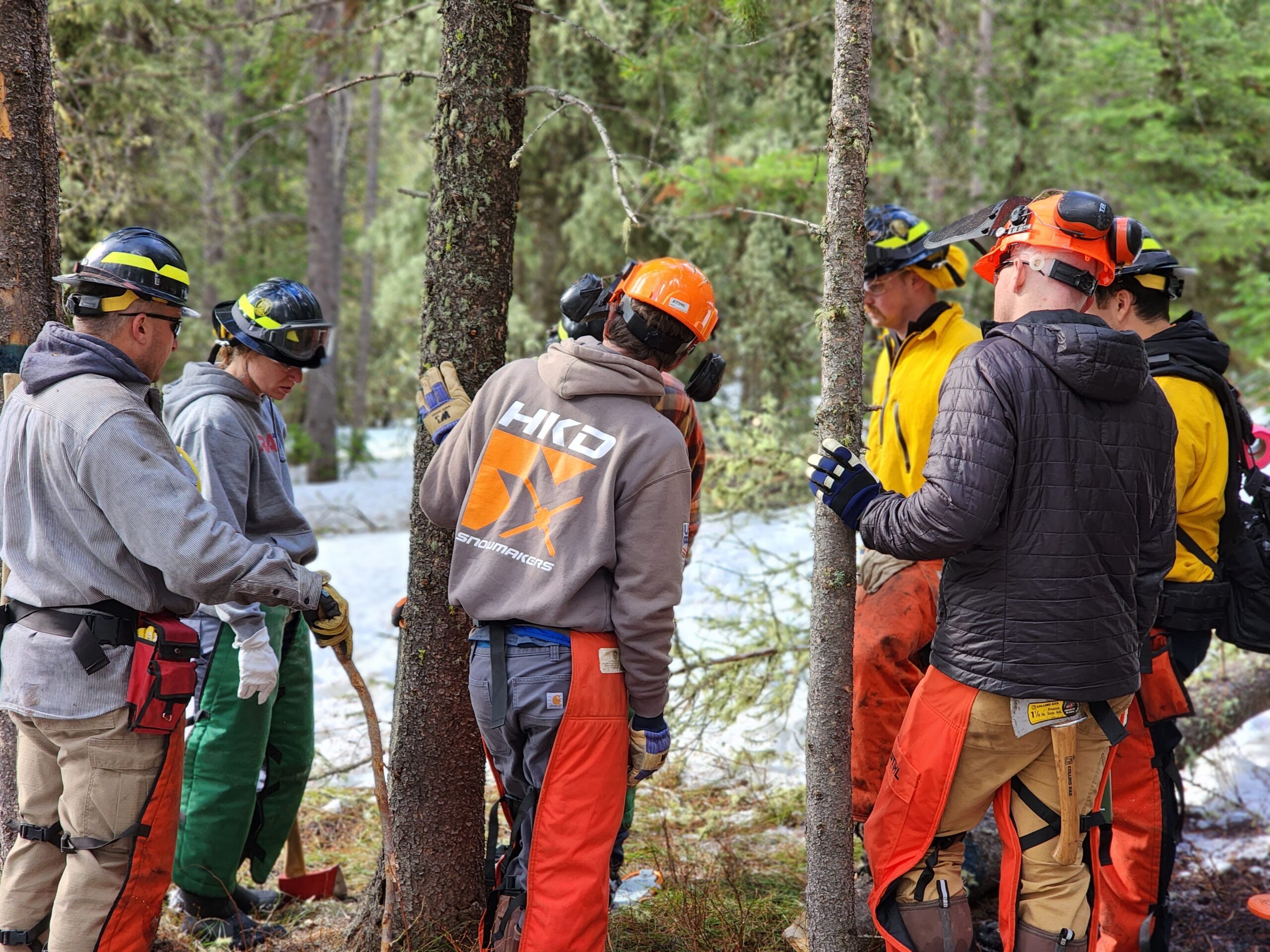
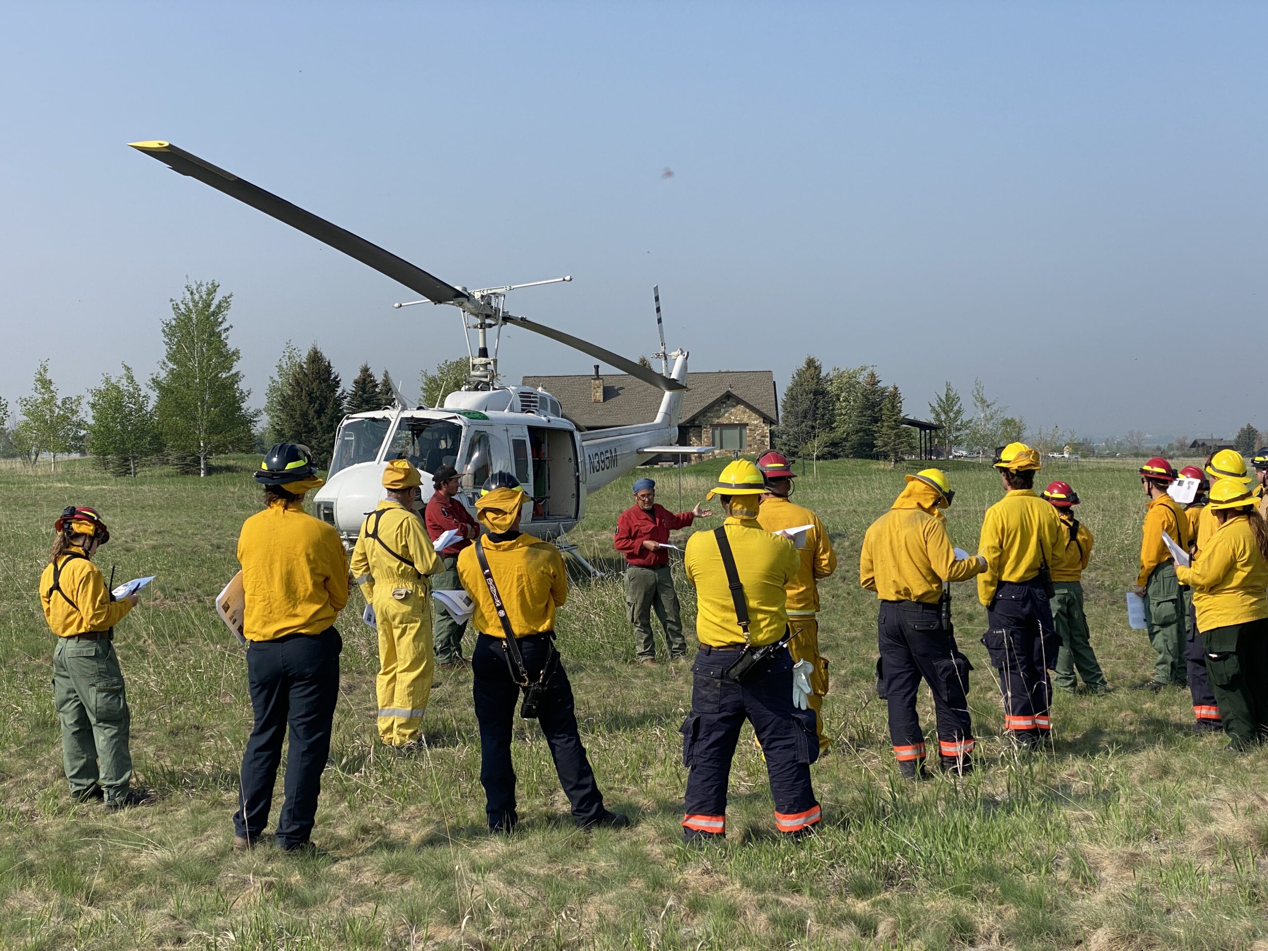
Training Season Wraps Up
June 10th, 2023Emergency Management supports a variety of training and exercise activities from fall to spring each year. This past training season saw our program supporting development of our county’s response personnel across a variety of topic areas including active killer response, reunification, helicopter operations, wildfire saw operations, basic wildland firefighting, incident commander, expanding incidents, task force leader and more for over 2000 student hours of instruction and exercise.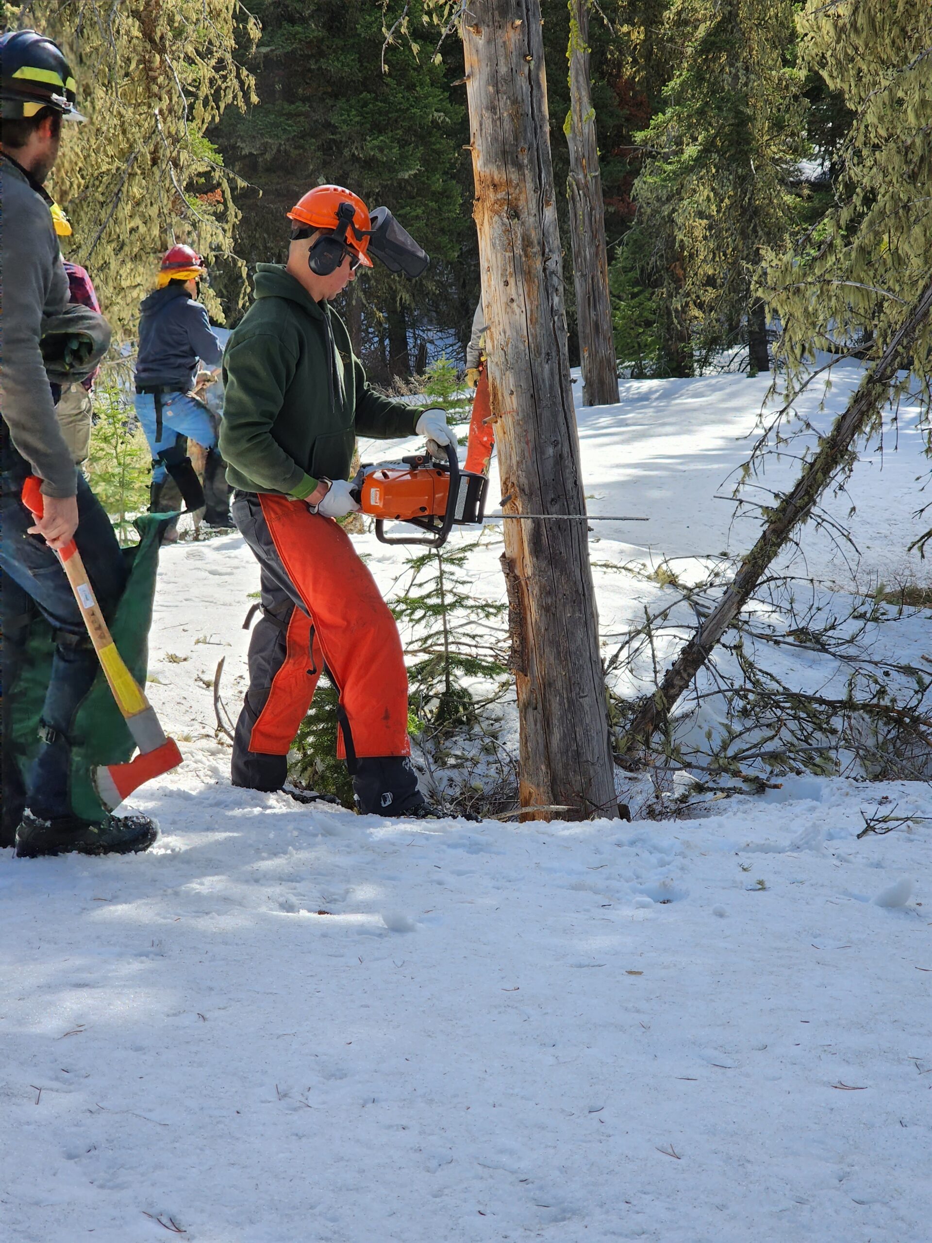

Debris Burning on Your Property
June 1st, 2023Burning is a common practice for many homeowners who want to get rid of yard waste such as leaves, branches, and other debris. However, if not done properly, yard burning can be dangerous and can cause serious harm to both humans and the environment. In this article, we will discuss some tips for safe yard burning.
- Check local regulations and weather
Before you start burning in your yard, it is important to check your local regulations and weather. Anything other than recreational fires withing Gallatin County require the purchase an annual Burn Permit and activation of it each day you plan to burn. Check the weather to ensure it is safe to burn and that the conditions won’t change throughout the day. Information on Open Burning regulations are available at: https://www.readygallatin.com/community-resources/burn-permits/. Typically, Open Burning will be shut down by fire departments when high fire risk exists, such as late summer.
![]()
- Choose a safe location
When selecting a location for yard burning, it is important to choose a safe spot. The area should be far away from any buildings, trees, or other flammable objects. You should also clear the area of debris and make sure the ground is free from any dry leaves or grass that will allow your fire to burn into unwanted areas.
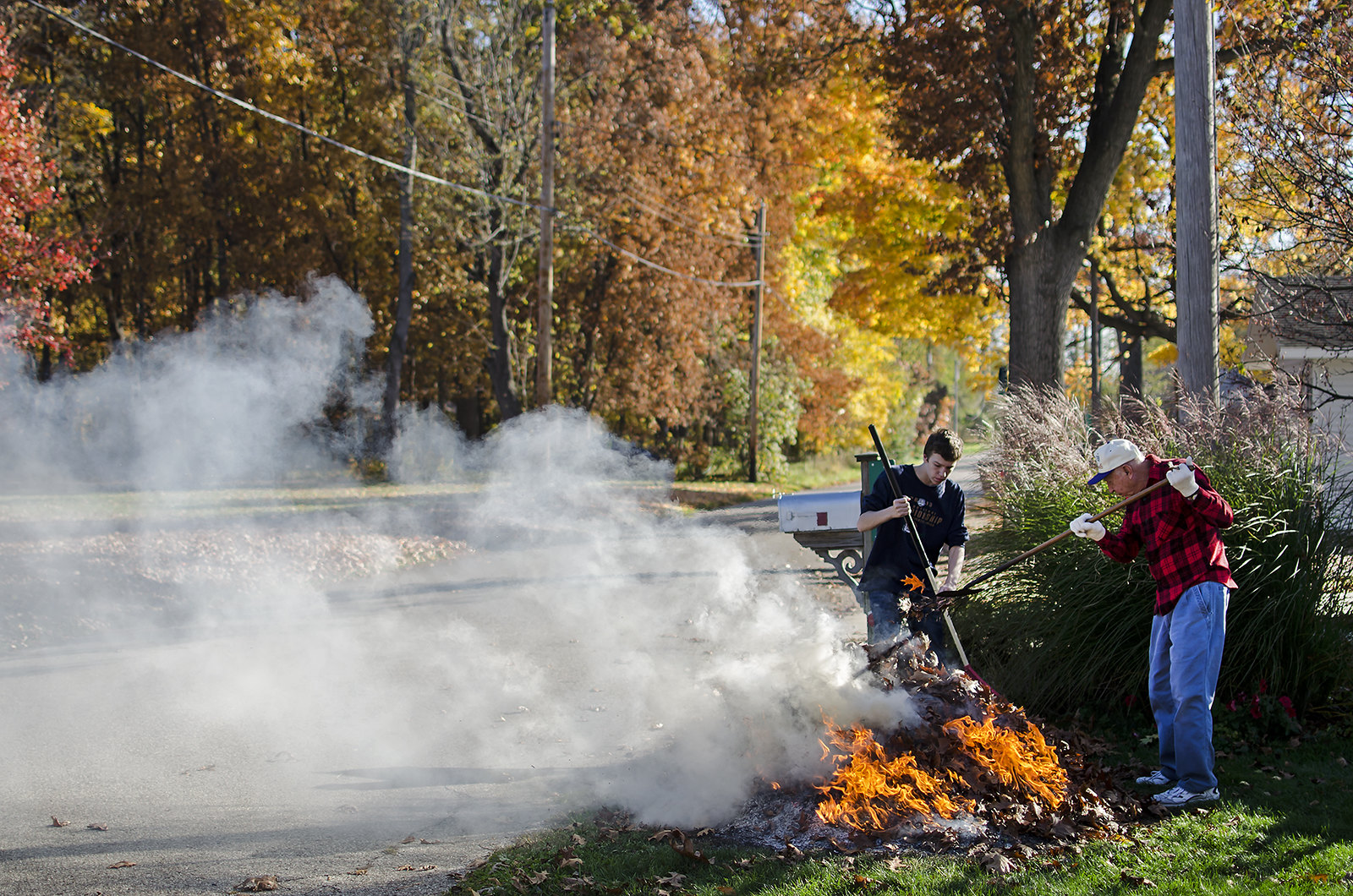
- Be prepared
Before you start burning, make sure you have all the necessary equipment on hand. You will need a hose or bucket of water or hose, a shovel, and a rake. You should also wear protective clothing, such as long sleeves and pants made from non-flammable materials.
- Start small
When you are ready to start burning, begin with a small pile of yard waste. This will allow you to control the fire and prevent it from getting out of hand. As the fire burns down, you can gradually add more debris to the pile.
- Monitor the fire
It is important to monitor the fire at all times. Never leave a burning pile unattended, and keep a close eye on the flames. If the fire starts to get out of control, use your hose or bucket of water to extinguish the flames.
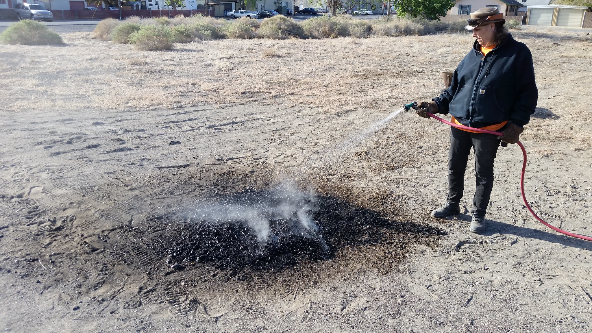
- Extinguish the fire properly
Once you have finished burning, make sure to extinguish the fire properly. Use your hose or bucket of water to thoroughly wet down the ashes and debris. Use your shovel and rake to mix the ashes and debris together, making sure everything is completely saturated.
In conclusion, yard burning can be a safe and effective way to get rid of yard waste, as long as it is done properly. By following these tips, you can help prevent accidents and ensure that your yard burning is both safe and effective.
Wireless Emergency Alerts
May 19th, 2023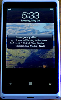 The Wireless Emergency Alert (WEA) system is a public safety system in the United States that allows government agencies to send emergency messages to wireless devices in specific geographic areas. The system was created to provide timely and accurate information to the public during emergencies, including natural disasters, terrorist threats, and other types of public safety incidents.
The WEA system was established in 2006 as part of the Warning, Alert, and Response Network (WARN) Act, which directed the Federal Communications Commission (FCC) to develop regulations for a nationwide alert system that would use commercial mobile service providers to send emergency messages to the public. The system officially launched in 2012 and has since been used to send alerts to the public during a variety of emergencies.
The WEA system operates using a technology called Cell Broadcast, which allows messages to be sent to all wireless devices within a specific geographic area, regardless of whether the device is subscribed to a particular service provider or has a specific application running. This means that even if a person is visiting an area and does not have local service, they will still receive the emergency alert message.
WEA messages are limited to between 90 and 360 characters (depending on several factors) and can include information such as the type of emergency, the affected area, and any actions that people should take to stay safe. The messages are sent by authorized government agencies, including the Federal Emergency Management Agency (FEMA), the National Weather Service (NWS), and state and local emergency management agencies.
There are four types of WEA alerts: Presidential Alerts, Imminent Threat Alerts, Public Safety Alerts and AMBER Alerts. Presidential Alerts are sent by the President of the United States and are used to alert the public to national emergencies, such as terrorist attacks or natural disasters. Imminent Threat Alerts are used to warn the public of immediate threats to their safety, such as a tornado or a chemical spill. Public Safety Alerts contain information about a threat that may not be imminent or after an imminent threat has occurred. AMBER Alerts are used to notify the public of a missing child, and can include information about the child and any suspect or vehicle associated with the abduction.
While the WEA system has been successful in providing timely and accurate information to the public during emergencies, there have been some concerns about the system’s effectiveness and potential for false alarms. In 2018, a false alert was sent to residents of Hawaii warning of an imminent missile strike, causing widespread panic and confusion. The incident highlighted the need for improved protocols and procedures to prevent false alerts from being sent in the future.
Despite these concerns, the WEA system remains an important tool for public safety officials to communicate with the public during emergencies. The system has been used to provide critical information to the public during hurricanes, wildfires, and other natural disasters, helping to save lives and protect property. As technology continues to evolve, the WEA system will likely continue to be updated and improved to better serve the public’s needs during emergencies.
WEA is complementary to the County’s Community Notification System and does not replace it as they both have weaknesses and strengths requiring the use of both depending on the incident and intended audience.
Learn more about public alerting at: https://www.readygallatin.com/public-warning/emergency-alert-system/.
Family Emergency Plan
May 12th, 2023Creating a family emergency plan is an important step in preparing for unexpected events that could affect your family’s safety and well-being. Here are some steps to follow to create a family emergency plan:
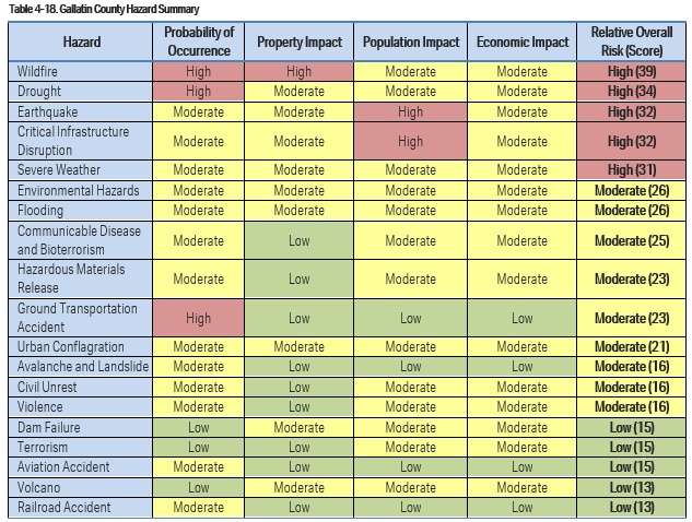
- Identify potential emergency situations: Start by identifying the types of emergencies that could happen in your area. These might include natural disasters such as floods, hurricanes, or earthquakes, or man-made disasters such as fires, chemical spills, or terrorist attacks. You can learn about identified risks in our communities at: https://www.readygallatin.com/community-resources/gallatin-county-risks/.
- Discuss the plan with your family: Involve all family members in the planning process and discuss the potential emergencies you have identified. Make sure everyone understands the plan and their role in it. More at: https://www.readygallatin.com/community-resources/family-emergency-plan/.
- Identify meeting places: Decide on a safe place where your family can meet in case you are separated during an emergency. This could be a neighbor’s house, a community center, or another location outside of your home.
- Create a communication plan: Agree on a method of communication in case of an emergency, such as a designated family member who will be responsible for contacting everyone.
- Prepare an emergency kit: Put together an emergency kit that includes essential items such as food, water, medications, first aid supplies, and important documents.
- Practice the plan: Regularly practice the plan with your family so that everyone knows what to do in case of an emergency. This will help ensure that everyone is prepared and can react quickly if needed.

- Ensure You Get Notified: Registering in the County’s Community Notification System is critical in ensuring you receive emergency information. Learn more and register at: https://www.readygallatin.com/public-warning/community-notification-system/.
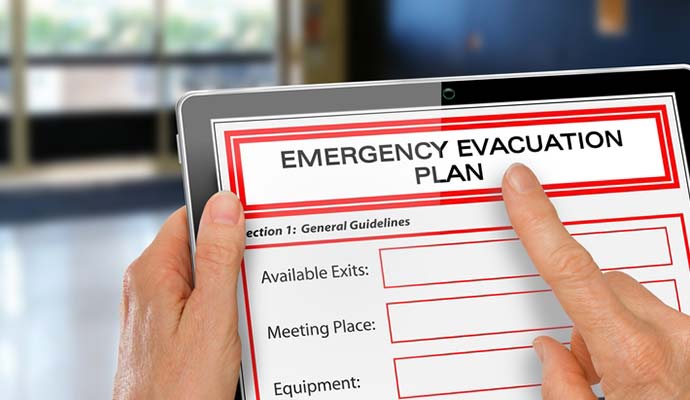
Remember to review and update your family emergency plan regularly to ensure it remains relevant and effective.
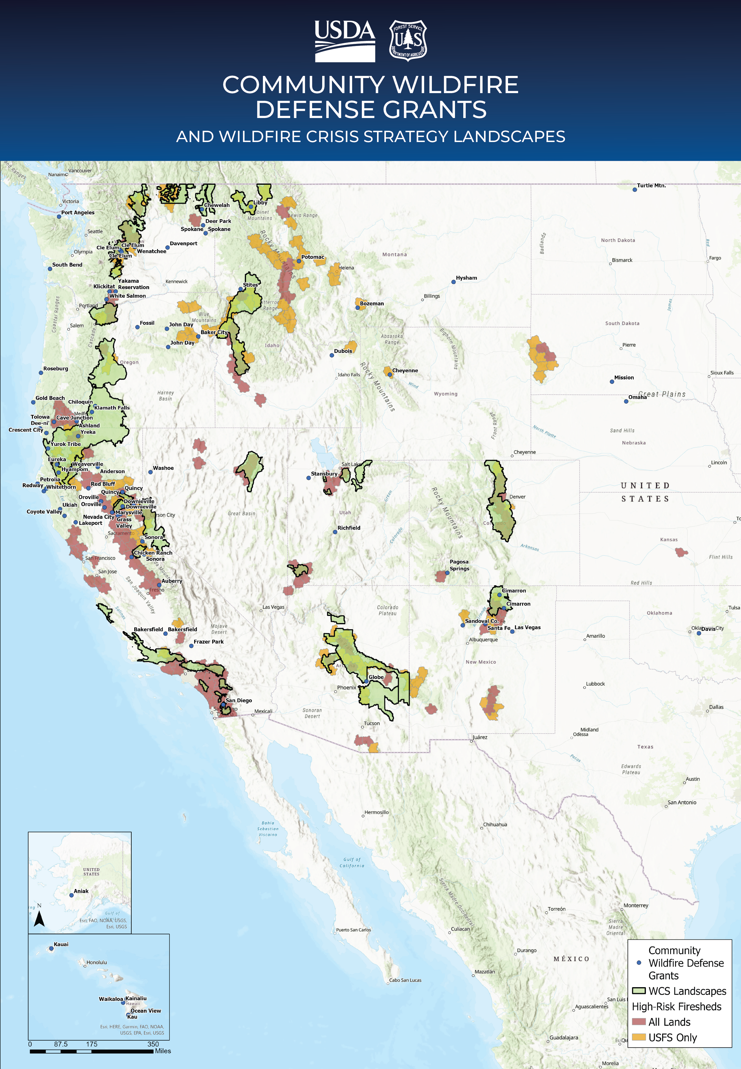
Gallatin County Awarded Community Wildfire Defense Grant
April 26th, 2023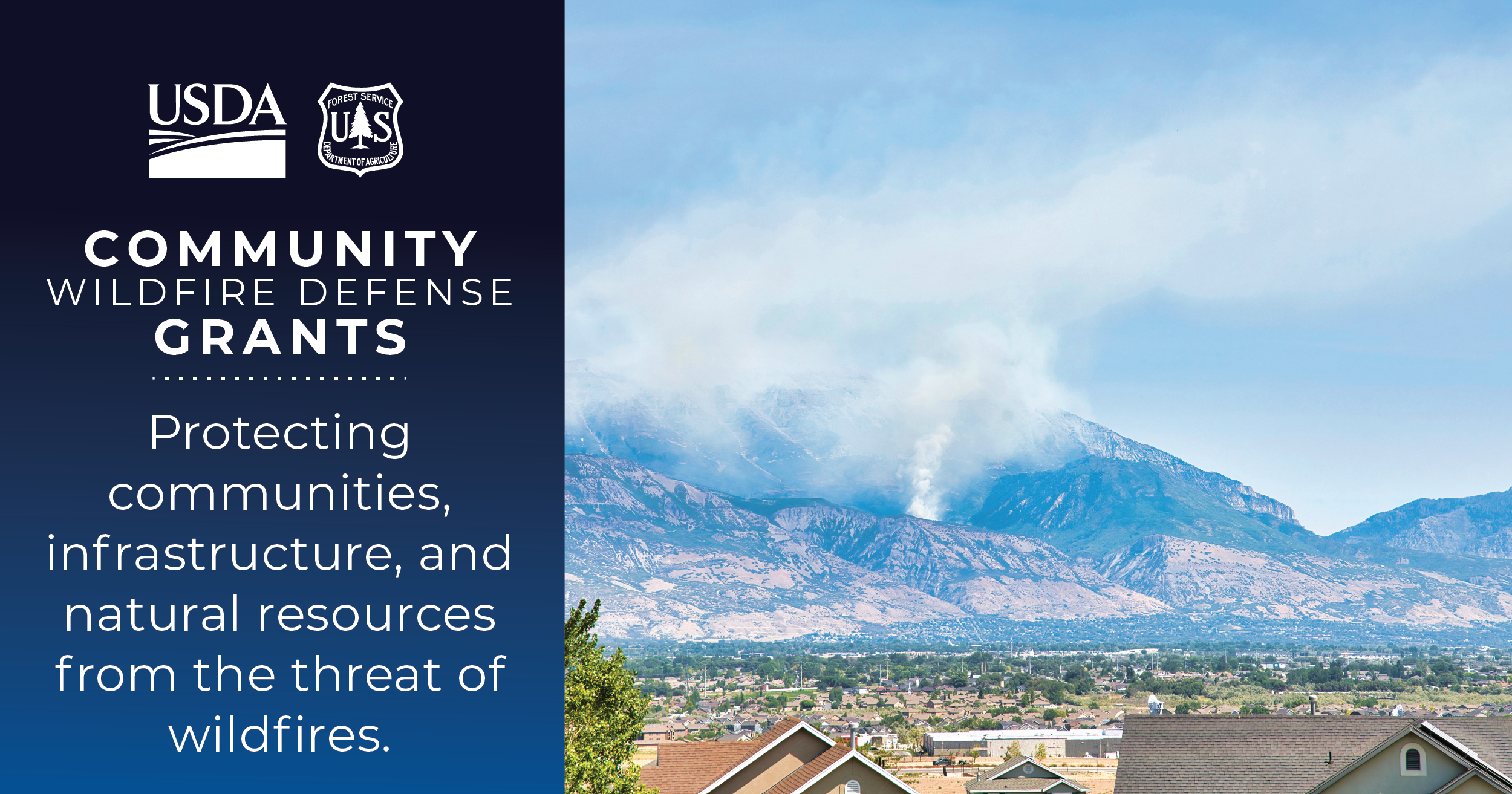
Gallatin County is pleased to announce that our North Gallatin Front wildfire mitigation project has been selected for funding through the Community Wildfire Defense Grant Program. This project will provide close to $1.6 million in funding from the USDA Forest Service to support land owners conducting wildfire mitigation work on their property. Gallatin County’s project is one of one hundred projects that was funded with $197 million in round 1 of this program across the United States. Our project is focused on the Northern Gallatin Front from Storm Castle in the Gallatin Canyon around the Gallatin Front to Bozeman Pass.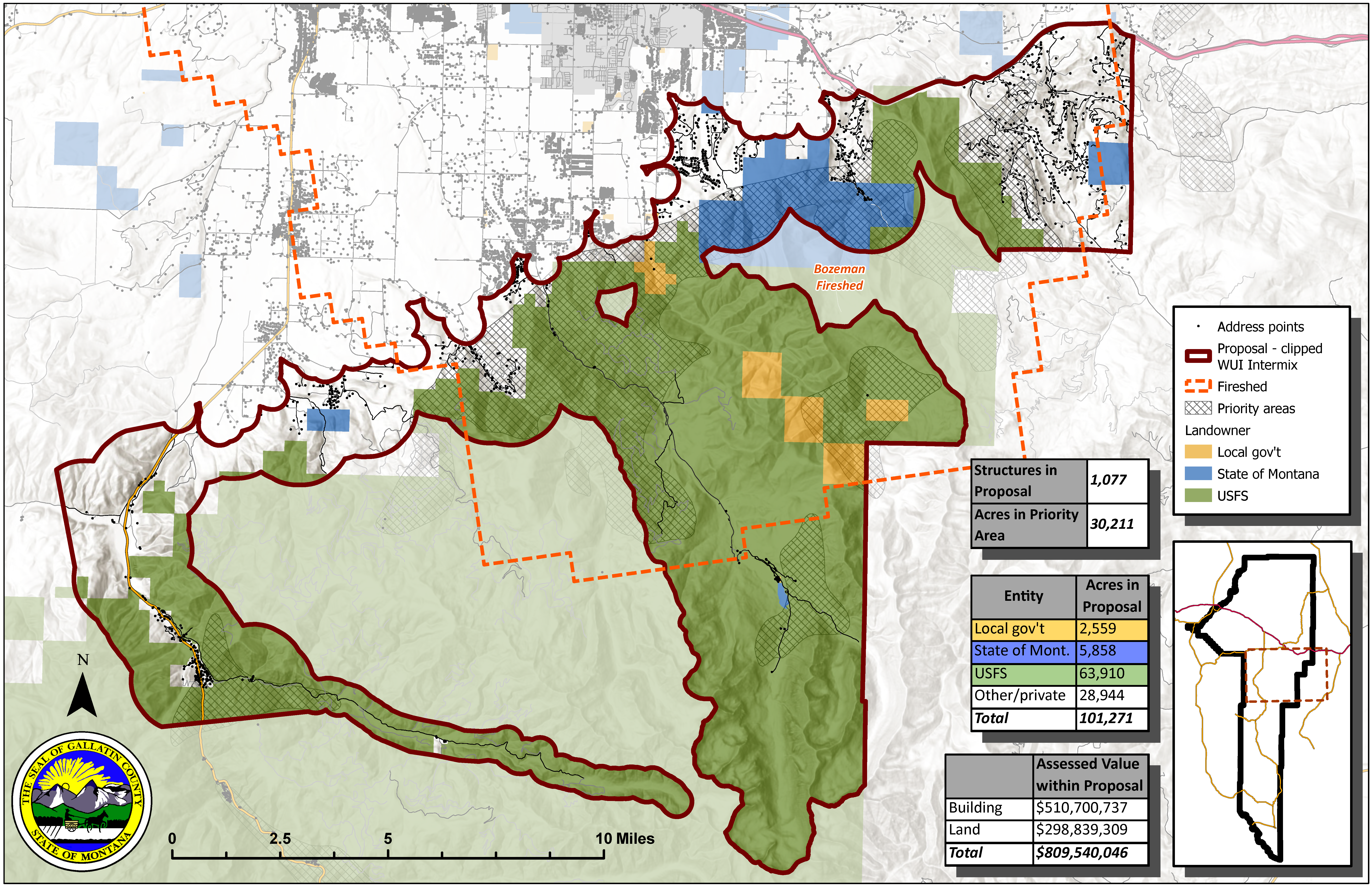
The project is written to support both home ignition zone work around houses as well as some larger landscape level projects. The Gallatin Front has several projects that have been completed, are in the process of being implemented, or are likely to occur in the future on city, state and federal public lands. This project was written to help conduct work on the adjacent private lands in this areas to create a more cohesive areas of treated areas across both the public and private lands. Funding will provide up to 60% reimbursement of the incurred costs for eligible work.
Learn more about the Gallatin County Wildfire Mitigation Program at ReadyGallatin.com/wildfire-mitigation.
Troy Downing: Are you ready for another flood season?
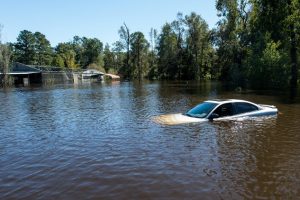
April 5th, 2023Article available at: https://csimt.gov/2023/03/21/troy-downing-are-you-ready-for-another-flood-season/
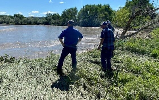
Commissioner Troy Downing stands on the bank of the Clark’s Fork of the Yellowstone speaking with a local rancher following the 2022 flooding.
My team and I were on the ground in eastern Montana helping families work with their insurance companies to rebuild immediately following the devastating flooding of 2022. Meeting at the civic center in Red Lodge with hundreds of Montanans, we learned the true extent of the damage and devastation families faced. As we drove down a county road just outside of Fromberg — the sound of water pumps grew louder as we approached a rancher’s home encircled by downed trees strewn across his property.
Standing on the bank of the Clark’s Fork of the Yellowstone, the rancher told us he had two feet of water in his basement. The damage to his home only confounded by the scene still playing in his mind of helplessly watching his cattle float down the river.
Stories like this are an upsetting experience shared by hundreds of Montanans. Unfortunately, displaced families returning to their damaged homes have scant options available to help them rebuild. Standard homeowner’s insurance policies do not cover floods. In one of the hardest hit areas — Carbon County — only 80 homeowners had flood insurance. Families were left with only one option, pay out of pocket to rebuild.
As our communities continue to rebuild in the face of another flood season, we Montanans must use the lessons learned last year to protect our homes, businesses, livestock, and farmlands from flood loss.
We graphically learned in 2022 homes not in high-risk flood areas may be vulnerable. Over 25% of homes damaged by floods are in low to moderate-risk areas. For example, the home caught on video floating down the Yellowstone last summer was likely not in a high-risk floodplain due to its elevation above the river. In this case, the fast, rising waters undercut the soil beneath expanding the bank of the river to the front door of the home.
Last summer, I spoke with hundreds of Montanans across the state whose homes and properties were damaged by flooding and without necessary coverage. Most considered policies either cost-prohibitive or were unaware coverage is available for homes that sit outside of floodplain maps. Among the few I spoke with who were covered, many only did so as a requirement of their mortgage.
There are insurance products available through the federal government with the National Flood Insurance Plan (NFIP), as well as private insurers. Private flood insurance may offer more affordable premiums, lower deductibles, and broader coverage options including higher maximums for damaged household items, such as appliances, clothing, and firearms. In addition, a recent rule amendment by the Federal Housing Administration allows homeowners with federally backed mortgages to purchase private flood insurance rather than NFIP plans through FEMA.
Before flood season begins, homeowners should sit down with a trusted insurance professional to discuss their risks and the insurance coverage options available. It is important to keep in mind many flood policies take thirty days to become effective. The cost of insurance verses the risk of loss deters many, but after last year, we are now acutely aware of the enormous potential of loss and damage to homes outside of high-risk areas.
Private flood insurance options are available and often less expensive than traditional federal flood insurance plans. Montanans should evaluate their risk and weigh the consequences of uninsured loss related to flooding.
Emergency Community Notifications
August 31st, 2022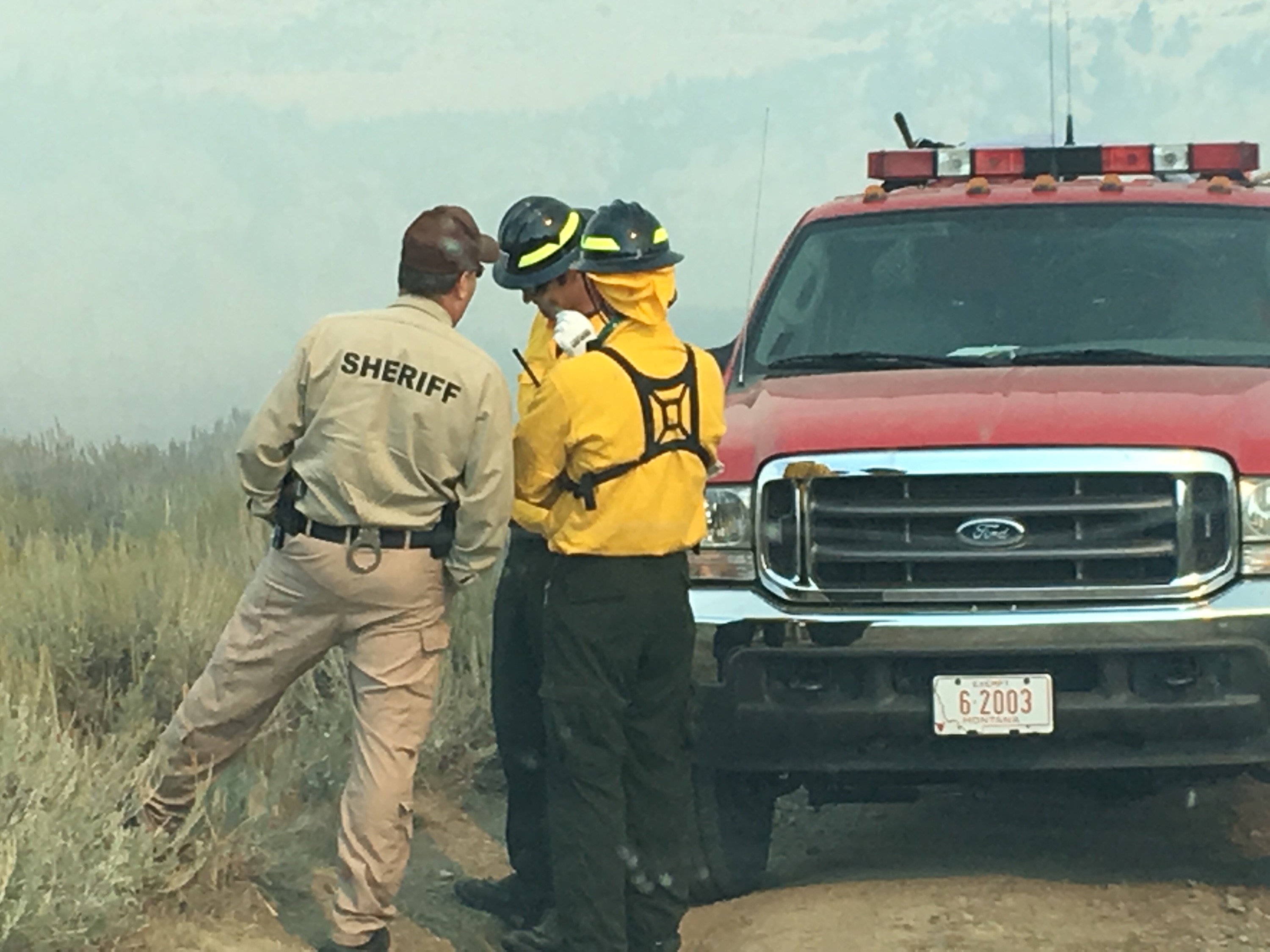
2018 Horseshoe Fire
Emergency officials ability to quickly and accurately distribute emergency information to those affected is critical for our community. This is also a large challenge for officials with the many different methods people in our community use for communicating and gathering news. However, you can help us and ensure you receive the emergency information you need.
All of Gallatin County is serviced by the Gallatin County Community Notification System, which is powered by Everbridge. This system allows you to register, identify how you want to be notified and the locations you care about. It also allows officials to target their messages geographically allowing specific messages to be issued to different communities and not unnecessarily disturb those who aren’t affected.
The key is that we need members of our community to register in the Community Notification System. While we do have some ability to distribute messages to those who have not registered, it is much less accurate and far from all encompassing. For example, many people don’t have land line phones anymore, and frequently if they do they assume the incoming calls are all telemarketers and don’t answer. Landlines are also locked to that address, so you wouldn’t receive an alert affecting your parent’s house or other location you care about.
The best way to ensure you are alerted in an emergency that is affecting you is to register in the Community Notification System, provide how you want to be notified, and the locations you want to be notified about.
Learn more about the Community Notification System at https://www.readygallatin.com/public-warning/community-notification-system/.

SPRING FLOODING – IT’S ALMOST THAT TIME
April 6th, 2022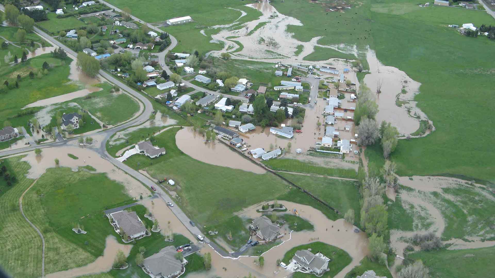 As Gallatin County moves closer to spring, the risk of spring flooding increases. While we can not predict if Gallatin County will see any spring flooding in 2022, we know that now is the time to prepare your property in order to minimize the potential effect of flooding.
The most prevalent cause of localized flooding are obstructed waterways that block the flow of water and cause it to go where you don’t want it. Now is the time to make sure ditches, culverts and other waterways on your property are clear of debris so we can keep as much water in them as possible.
Additionally, if you feel your property is at risk of flooding, you may want to consider flood insurance. Flood damage is not covered by homeowners insurance. Flood insurance has a 30 day waiting period for the policy to take effect, so you can not wait until flooding is imminent to get a policy. Contact your insurance agency for policy information.
Now is also the time to develop your plan on how you will protect your property if you are affected by flooding later this spring. Once flooding occurs, the damage is done. So developing your plan now, and implementing it early is critical to minimizing damage.
More information on flooding is available at: http://www.readygallatin.com/community-resources/preparedness-information/flooding-in-gallatin-county/.
View the Keep It Flowing educational video at: https://youtu.be/z_LtMhhyiqo
Hazard Mitigation and Community Wildfire Protection Plan Adopted
March 26th, 2021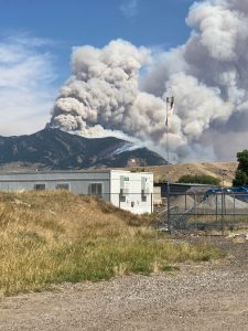 After many delays the update of the County’s 2012 Hazard Mitigation Plan and the 2006 Community Wildfire Protection Plan into the combined 2020 Hazard Mitigation and Community Wildfire Protection Plan is complete. This document evaluates risk is various locations around the county and identifies potential projects that could be undertaken to minimize the effects of the identified risks through mitigation projects. Having a current adopted plan also makes our communities eligible to access federal mitigation funding to support these mitigation activities. This document must be revised every 5 years and will be updated again in 2026.
Spring Flooding – It’s Almost That Time
March 10th, 2021As Gallatin County moves closer to spring, the risk of spring flooding increases. While we can not predict if Gallatin County will see any flooding in 2021, we know that now is the time to prepare your property in order to minimize the the potential effect of flooding.
The most prevalent cause of localized flooding are obstructed waterways that block the flow of water and cause it to go where you don’t want it. Now is the time to make sure ditches and culverts on your property are clear of debris so we can keep as much water in them as possible.
Additionally, if you feel your property is at risk of flooding, you may want to consider flood insurance. Flood damage is not covered by homeowners insurance. Flood insurance has a 30 day waiting period for the policy to take effect, so you can not wait until flooding is imminent to get a policy. Contact your insurance agency for policy information.
Now is also the time to develop a plan on how you will protect your property if you are affected by flooding later this spring. Once flooding occurs, the damage is done. So developing a plan now, and implementing it early is critical to minimizing damage.
More information on flooding is available at: http://www.readygallatin.com/community-resources/preparedness-information/flooding-in-gallatin-county/.
View the Keep It Flowing educational video at: https://youtu.be/z_LtMhhyiqo
Family Emergency Plan
August 19th, 2019Being prepared doesn’t need to be hard!
1. Will you receive direct notifications from emergency officials? Often once of the more challenging pieces of a large emergency if providing accurate information quickly to those who need it. The best way to ensure you receive information directly to you from officials in Gallatin County is to register in the Community Notification System at Alerts.ReadyGallatin.com.
![]()
2. If you can’t leave your home, or place of work, do you have the supplies you need to be self sufficient for several days? Our society has become an on demand world on many levels with many people not maintaining a stock of their needed supplies, but rather getting replacements when they run out. For a variety of reasons, this doesn’t work in a disaster. Identify what you need in order to be self sufficient and maintain a surplus of these items.
3. Frequently the most disrupting parts of a disaster is when it is not safe for individuals to stay where they are (and are comfortable). Have you thought about if you had to quickly leave your home, or place of work (and couldn’t go home)? Where would you go and is this a common location that your family is also heading to, and what critical items do you need to take? Critical items include irreplaceable personal belongings, but also the items you will need to function while displaced.
Items to consider include:
- Identification
- Medications
- Pets (and supplies)
- Cash
- Important Documents
- Baby Supplies
- Jewelry and other family heirlooms
- Clothes
- Proof of Address (utility bill)
4. Does everyone know the plan? Review the plan periodically with your entire family. Repetition is important because if you are ever affected by a large event there will be significant stress and it will likely be an experience you have not been through before. Everyone knowing the plan without having to think about it is critical.

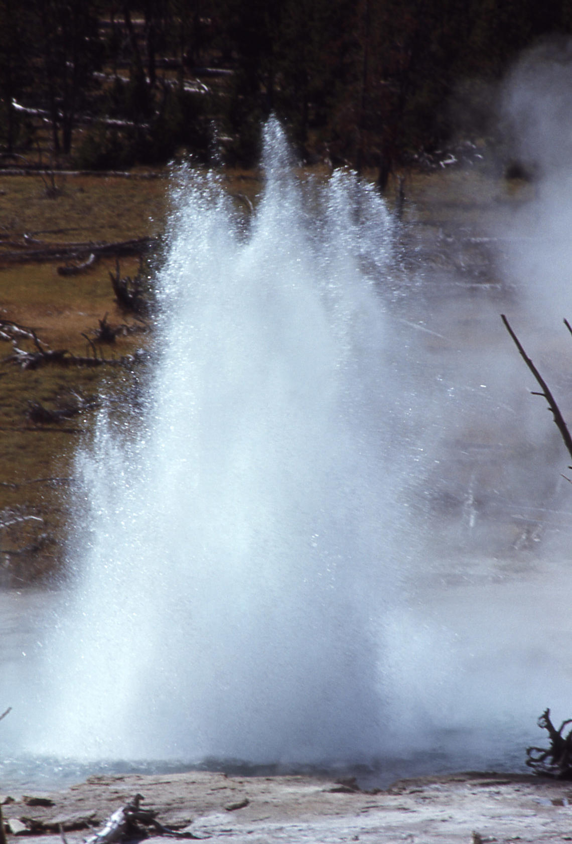
60th Anniversary of Hebgen Lake Earthquake – 8/17/2019
August 16th, 201960 years since the 1959 M7.3 Hebgen Lake earthquake: its history and effects on the Yellowstone region
Yellowstone Caldera Chronicles is a weekly column written by scientists and collaborators of the Yellowstone Volcano Observatory. This week’s contribution is from Jamie Farrell, assistant research professor with the University of Utah Seismograph Stations and Chief Seismologist of the Yellowstone Volcano Observatory.
We often hear about the potential for large volcanic eruptions of the Yellowstone volcano in the news and on television shows. However, we rarely focus on the threat of large earthquakes in the region, even though the hazard and risk from these types of events is much larger than a volcanic eruption because they happen so much more frequently.
As we approach the 60th anniversary of the M7.3 Hebgen Lake earthquake, which occurred on August 17th, 1959 at 11:37 PM (MST), it seems appropriate to discuss the effects of the earthquake on the region, and what we might expect if a similar sized event happens in the near future.
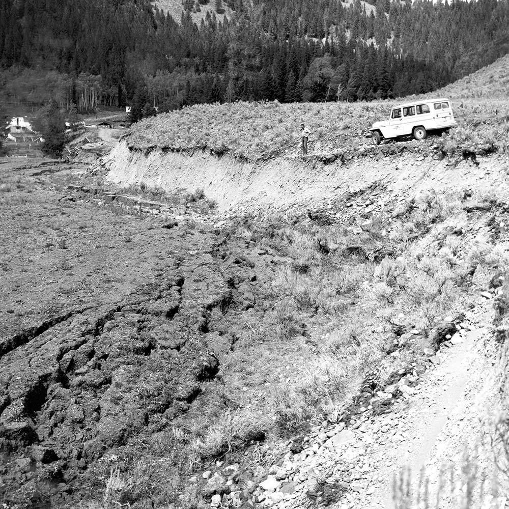
Hebgen Lake fault scarp in 1959. (Credit: J. R. Stacy, USGS. Public domain.)
First, let’s talk about the earthquake itself. The official magnitude of the earthquake is 7.3, and it was located just outside the western boundary of Yellowstone National Park, ~6.5 miles WNW of West Yellowstone, Montana. The earthquake caused 28 fatalities, with most of those as a result of a large landslide that was triggered in the Madison Canyon. That landslide carried ~50 million cubic yards of rock, mud, and debris down the south side of the canyon and half way up the north side, partially burying the Rock Creek campground on the valley floor. The landslide also dammed the Madison River, causing water to back up behind it creating EarthquakeLake.
The earthquake caused up to ~18-20 feet of offset on the surface (fault scarps) that can still be seen today on both the Hebgen Lake and Red Canyon faults and, to a lesser extent, the Madison fault. Within nearby Yellowstone National Park, many rock slides blocked the roadways, and there was damage to the world famous Old Faithful Inn, where a large rock chimney collapsed.
But maybe even more spectacular were the effects of the earthquake on the hydrothermal features in Yellowstone National Park. By the day after the earthquake, at least 289 springs in the geyser basins of the Firehole River had erupted as geysers; of these, 160 were springs with no previous record of eruption. At least 590 springs had become turbid. During the first few days after the earthquake, most springs began to clear, but several years passed before clearing was generally complete. In addition, new hot ground soon developed in some places and this became more apparent by the following spring with the formation of new fractures in sinter and linear zones of dead or dying trees. Some new fractures developed locally into fumaroles, and a few of these evolved into hot springs or geysers.
Rockslide damage to the Golden Gate area near Mammoth Hot Springs, Yellowstone National Park, as a result of the 1959 Hebgen Lake earthquake. (Public domain.)
Two of the most spectacular changes were the formation of Seismic Geyser and the changes to Sapphire Pool. Seismic geyser (located in the Upper Geyser Basin) started out as a newly formed fracture after the Hebgen Lake earthquake. The fracture slowly evolved into a fumarole, and in about 2.5 years it evolved into a small geyser. A few years later, it had changed into a very vigorous geyser that erupted to heights up to 50 feet and excavated a vent with a maximum diameter of ~40 feet and more than 20 feet deep. In 1971, major eruptions ceased at Seismic geyser as activity shifted to a new, small, satellite crater that formed nearby.
Prior to the Hebgen Lake earthquake, Sapphire Pool (located in Biscuit Basin) erupted about every 17 to 20 minutes to a height of 3 to 6 feet. Following the quake, and until September 5, it surged 6 to 8 feet high constantly. On September 5, its steady boiling and surging became periodic, and the spring changed into a major geyser. Its eruptions were quite regular, occurring about every 2 hours, and were massive and spectacular; some of the bursts were 150 feet high and 200 feet across! From September 14 to 29 it reverted to a steadily surging cauldron. On September 29 it again became a major geyser, and this activity persisted until 1968. Sapphire pool today is still a crystal-clear, blue-water pool, and it still violently boils and surges on occasion.
For the first few days after the earthquake, Old Faithful was observed to be more erratic than usual, with successive longer and shorter intervals between eruptions, but that had been observed prior to the earthquake as well. The average eruption interval the summer prior to the earthquake was 61.8 minutes—the shortest seasonal average on record. By September 1 it had increased to 62.1 minutes. Two hundred and fifty-five eruption intervals timed during the last 10 days of December showed an average interval of 67.4 minutes. Old Faithful’s eruption interval has continued to increase since that time and is now averaging ~93 minutes. Was this a direct result of the Hebgen Lake earthquake?
Seismic geyser in eruption in 1970. (Credit: John Brandow, USGS. Public domain.)
The Hebgen Lake earthquake continues to be the largest earthquake to occur in the U.S. Intermountain West in historic times. As we approach the 60th anniversary of this event, we should remind ourselves that the area around Yellowstone (and much of the Western U.S.) is earthquake country. Earthquakes happen nearly every day in the region, and occasionally the area produces strong earthquakes that are capable of affecting large areas and causing damage. We should expect similar effects if another earthquake of this size would to happen today, except there are many more people visiting the area today than there were in the summer of 1959. The more we are prepared for earthquakes, the better we will be after one happens.
To commemorate the 60th anniversary of the Hebgen Lake earthquake, the Earthquake Lake Visitor Center operated by the U.S. Forest Service, will be hosting a number of events leading up to August 17th, including several public lectures. The schedule can be viewed here.
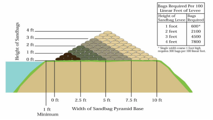
Utilizing Sandbags
February 13th, 2019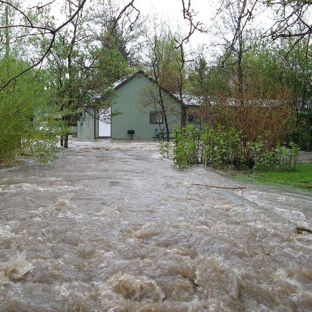
Utilizing sandbags for flooding events can be a very effective tool in preventing damage to property. However, like any flood fighting tool they need to be implemented before you are affected by flooding.
1 To properly utilize sandbags, first identify how many sandbags you will need by determining the height of your levy and the distance you want to cover. The amount of sandbags needed is often underestimated. The US Army Corp of Engineers utilizes this as an estimation:
2 You need to procure your sandbags. The best source for bulk sand bags in Gallatin County is Bozeman Brick, Block and Tile on Jackrabbit (587-4283). They can provide empty bags, filled bags and can deliver them.
3 Once you procure the bags, how you deploy them is critical in order for them to function correctly. Bags must be interlocked, stacked in a pyramid shape, and positioned facing the water flow. For instructions on stacking bags, watch this video from San Diego County:
Reference material is also available from the US Army Corps of Engineers and Santa Cruz County.
Remember to develop your flood fighting plan and implement it before you are directly impacted by flooding. It takes time to procure the needed supplies and put them in place!
When flooding occurs, be safe and use caution when working around flood waters.
Annual Community Notification System Update
January 4th, 2019 Each year I send one message to everyone who has registered the Community Notification System to share changes, pass on lessons learned and provide some answers to frequently asked questions. Additionally, I ask that if you had a change like a new phone number, moved, or other changes, to please take a moment to update your information in the Community Notification System.
In 2018 we sent emergency messages supporting four emergency incidents around Gallatin County consisting of:
- Law enforcement search for armed suspect who shot at a deputy.
- Evacuation for a wildfire in Clarkston.
- Dam failure that affected 16 Mile Creek.
- Missing child in Manhattan.
In addition to these emergencies, messages were also sent for non-emergency situations to people who opted in for those additional messages.
Changes in 2018
In 2018 Gallatin County entered into an agreement with Montana State University to share the Community Notification System. This consolidation created a single mass notification system for everyone in Gallatin County. Now, if an emergency occurs in the area of MSU we can send one message to everyone affected making our alerting more effective. The University maintains some student specific groups in the system for employees and students that allow them to target messages that are specific only to campus. It appears that having a single shared mass notification system is not that common around the country, but we think it is a great idea to have one system that everyone uses.
The opt out capability has been enhanced in our system. Phone calls, emails and text messages now contain the option to opt out from receiving them again. Keep in mind that if you opt out of a message, you won’t receive any type of messages in the future from us. If you receive a type of message you prefer to no longer receive, please change your settings (see FAQ below) rather than opt out.
Lessons Learned
Our alerting was fairly successful in 2018 with the four emergencies Gallatin County supported. It continued to be reinforced that land line telephones are not a reliable alerting method, especially during a visible emergency. The importance of encouraging our community to register in the Community Notification System continues to become even more critical for successful emergency messaging.
I’m sure you saw some of the media coverage from the California wildfires talking about how mass notification systems were and weren’t utilized in various situations. The same challenges faced in California, we struggle with here in Gallatin County as we strive to never abuse the system and always provide clear messaging to the community. Much of the debate in California centers around a technology known as Wireless Emergency Alerts (WEA), which is a capability we have. This technology sends an alert to all cell phones in a given area with a text message and is the same system utilized for an AMBER Alert. The challenge today with WEA is that the smallest area we can alert is an entire county, so that is everything between West Yellowstone and Maudlow. Additionally, we can only include 90 characters and no websites or phone numbers. So, the challenge is, does the incident affect the entire county and/ or can we clearly describe who is affected and what people are to do in 90 characters? Rest assured, if an emergency warranted alerting the entire county of an emergency, your officials will do so. However, our preference is to target our messaging to those who are actually affected and provide the most complete information and directions that we can. The Federal Communications Commission is working with the cellular providers to implement changes that will alleviate the current challenges, but I don’t expect those to be implemented for a couple years.
In September, Montana State University issued an alert to their internal employee and student lists for a black bear on campus. This caused some confusion among recipients about why they were receiving a message branded as the Gallatin County Community Notification System. After reviewing this incident, future messages from the University will include a line stating that the message was being sent by the Montana State University Police Department to provide clarity on where the message is coming from.
Frequently Asked Questions
How do I update my information in the Community Notification System?
Visit Alerts.ReadyGallatin.com
Your username is likely the email account you received this message at.
Why am I receiving this email, I never signed up for this?
Someone signed you up. Every time we’ve been asked this question, it turned out that a family member signed up and they often have a shared email account.
Why am I getting road closure information?
When you registered you were given the option to select additional information you wanted to receive. Sometimes people inadvertently selected these optional selections. To no longer receive them, log into the Community Notification System and unselect them. These selections have nothing to do with receiving emergency notifications (if you’re registered and in an affected area, you’ll receive emergency messages).
I downloaded the Everbridge App, am I covered?
Partially. If you downloaded the Everbridge App, that is great and you will receive alerts when your phone is physically located in an area receiving an alert. We recommend that people also register so that we know the locations you care about. That way if something happens near your home, but your phone isn’t physically there at the time, you will still be alerted because you registered that address.
Can I create a single account for my entire family?
Yes, but we don’t recommend it. We recommend that every individual register for their own account. For emergency messages, the Community Notification System always asks for confirmation of receiving the message. Once someone confirms, it stops spending time trying to reach that account. So, it is possible that if you have a shared account and one person confirms the message they received, that another person who hasn’t been messaged yet will not get alerted. To be safe, have everyone register themselves in the Community Notification System.
Where can I learn more about the Community Notification System?
http://www.readygallatin.com/public-warning/community-notification-system
The Difference Mitigation Makes
December 3rd, 2018
1964 Anchorage Earthquake
In the Emergency Management world mitigation activities are sometimes the most challenging projects to justify funding requests for when officials compare those to the multitude of immediate need requests. When we talk about mitigation, emergency managers are looking for projects where money spent now will reduce the loss later in a large disaster. This loss can either be lives or monetary in nature that we are trying to reduce by making buildings and infrastructure more resilient, working with individuals to prepare themselves and their properties, and many other similar projects that reduce the impact from known hazards in a community. In 1964 Anchorage experienced a magnitude 9.2 earthquake that killed hundreds and caused millions in damage.
Following the 1964 earthquake Anchorage spent a lot of time debating what could be done to minimize the damage the next time a major earthquake occurred. In the coming years building requirements were established requiring earthquake building standards and limitations on where certain buildings can be constructed. Development was also limited in locations that were not geologically secure during an earthquake.
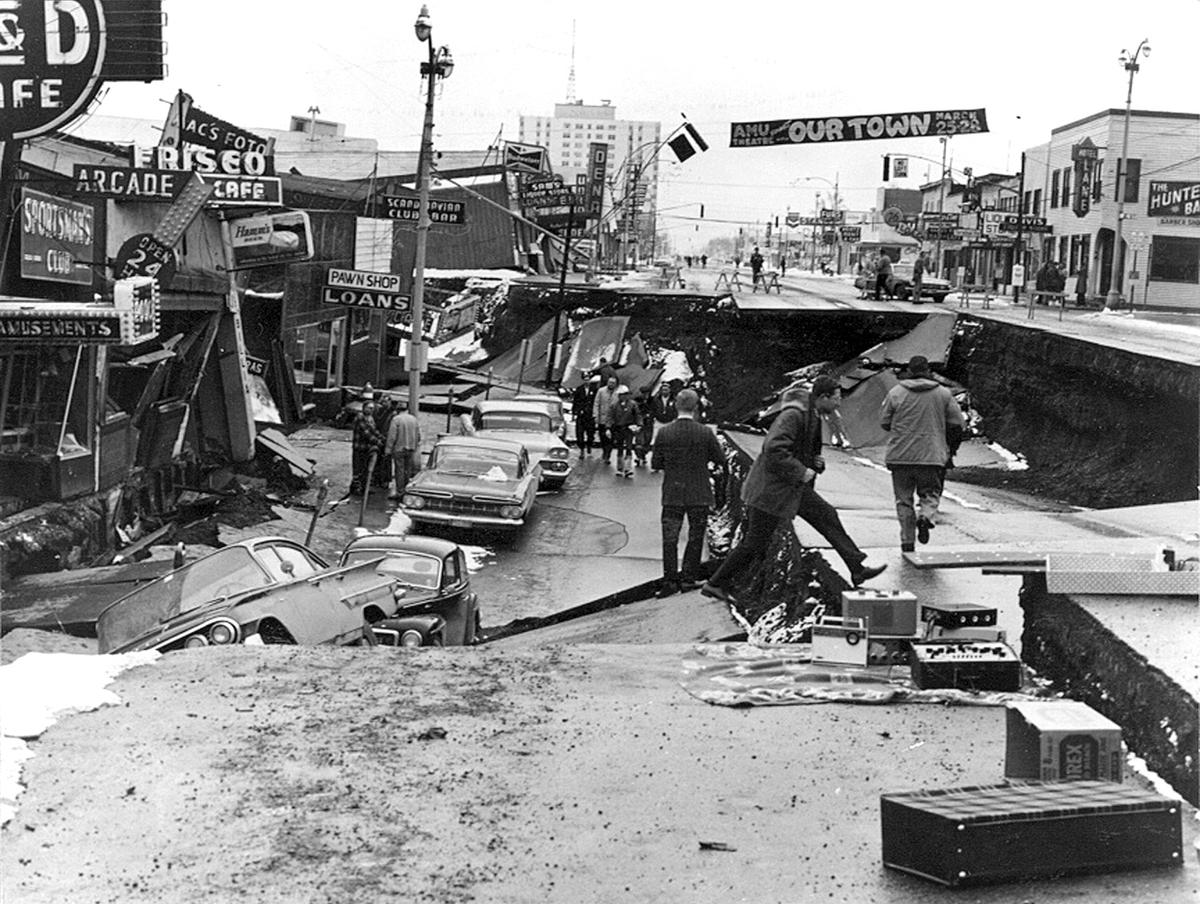
1964 Anchorage Earthquake
54 years later Anchorage was again tested with a large earthquake. While smaller than the 1964 quake, the magnitude 7.0 earthquake in 2018 was large enough to cause significant damage, and it did. However compared to other places of the world where similar earthquakes have caused complete destruction and loss of life, Anchorage’s new quake caused damage and no fatalities.
Charles Wohlforth explains in his recent article in the Anchorage Daily News how the changes in Anchorage’s building after 1964 can be directly attributed to the comparatively good outcome in 2018. The lessons in Anchorage are well worth thinking about and employing here in the Northern Rockies.
More on Earthquake Preparedness
Bozeman’s Doug Chabot Inducted into Hall of Mountaineering Excellence
May 10th, 2018Every year the American Alpine Club honors multi-dimensional and impactful climbers who have made meaningful and lasting contributions to the mountains and their vibrant communities be it through culture and community, environmental responsibility and stewardship or the arts and sciences, by inducting them into the Hall of Mountaineering Excellence.
This year’s recipients will be inducted into the Hall of Mountaineering Excellence on June 2 at the American Alpine 2018 Excellence in Climbing Celebration to be held in Denver, Colorado. […]
Doug Chabot is being recognized for co-founding the non-profit Iqra Fund. This organization helps provide access to quality education, especially for girls, in the remote regions of northern Pakistan where economic, social and political barriers to education exist. Chabot resides in Bozeman, Montana, where he is the director of the Gallatin National Forest Avalanche Center and also volunteers at Gallatin County Search and Rescue . More on Doug and his inspiring work can be found in this article from Outside Bozeman.
Excerpt from: Rock and Ice
Cell Service in Bridger Canyon…
May 7th, 2018Until April cellular service in Bridger Canyon was spotty at best, but that all changed recently. At the end of the ski season a cellular site was turned on at Bridger Bowl providing service for both Verizon and T-Mobile customers. Now phones work reliably within a couple miles of the ski area and the higher in the mountains you get, the wider the coverage is.
This doesn’t negate the importance of being properly prepared when you recreate in Bridger Canyon. Accidents still happen and it can take a long time to get help to you, so be prepared to be self sufficient when you go out.
- Tell someone where you are going.
- Be prepared for the weather and have emergency supplies.
- Plan ahead and have a contingency plan. If something does happen, stay put!
The Mountain Rescue Association recommends travelling with the following “10 Essentials” for summer travel:
1. Topographic map and magnetic compass
Too often, backcountry users venture deep into the backcountry without a map and compass. The fact that they are able to safely venture back out is usually pure
dumb luck. With a map and compass, it is much easier to identify your location and direction of travel. This is especially important in the event that you become lost.
2. Flashlight (with extra batteries and bulb)
How far do you suppose you could safely travel at night in the backcountry without a flashlight? Could you signal others, if you saw a campsite far away? A flashlight makes travel at night possible and aids in signaling when lost.
3. Extra clothing (including mittens, hat, jacket and rain gear)
Hypothermia is the most common killer of backcountry users. Inability to maintain body heat can quickly rob an unsuspecting victim of all energy and common
sense. Since severe weather may present itself very quickly in the backcountry, extra clothing should be carried to help maintain body heat.
4. Sunglasses
Especially in the winter, ultraviolet glare from the sun can cause blindness. Worst of all, the backcountry user may not realize this is happening until it is too late. A good pair of sunglasses, designed to limit ultraviolet light, will eliminate this risk.
5. Extra food and water
These items will maintain energy levels in the case of an emergency and help maintain body temperature in cold weather. While you can survive three days without water and three weeks without food, your energy levels will be seriously
depleted without these.
6. Waterproof matches in waterproof container
Waterproof matches, available from most backcountry supply stores, are capable of igniting in high winds and/or blinding rain. Building a fire may be impossible
without these. Fires are critical since they not only provide heat, but also make the job of search and rescue teams easier by providing a visible signal.
7. Candle/Fire starter
A candle burns much longer than does a match. This is helpful when trying to start a fire, especially if your firewood is wet.
8. Pocket knife
There are a multitude of applications for a pocketknife in emergencies. The common Swiss Army Knife is so-called because it is standard issue for the Swiss Army, which has devised 246 uses for their standard 7-instrument knife.
9. First aid kit
Proper first aid care is difficult, if not impossible, without a good first aid kit.
Backcountry shops carry several brands of small, lightweight first aid kits including small first-aid manuals.
10. Space blanket or two large heavy-duty trash bags
These items can help provide shelter in an emergency situation and can be used as a raincoat or a windbreak. The additional warmth they provide far outweighs their minimal weight.
Source: General Backcountry Safety, MRA